History
History
OUR STORY begins in the early 1970s, when landowners along the Blackfoot River recognized the need to build partnerships with public agencies in order to address natural resource threats facing the watershed. By focusing their early efforts where they agreed, these partners realized they could accomplish much more by working together. These early conversations paved the way for what would become public stream access and walk-in hunting on private lands in Montana.
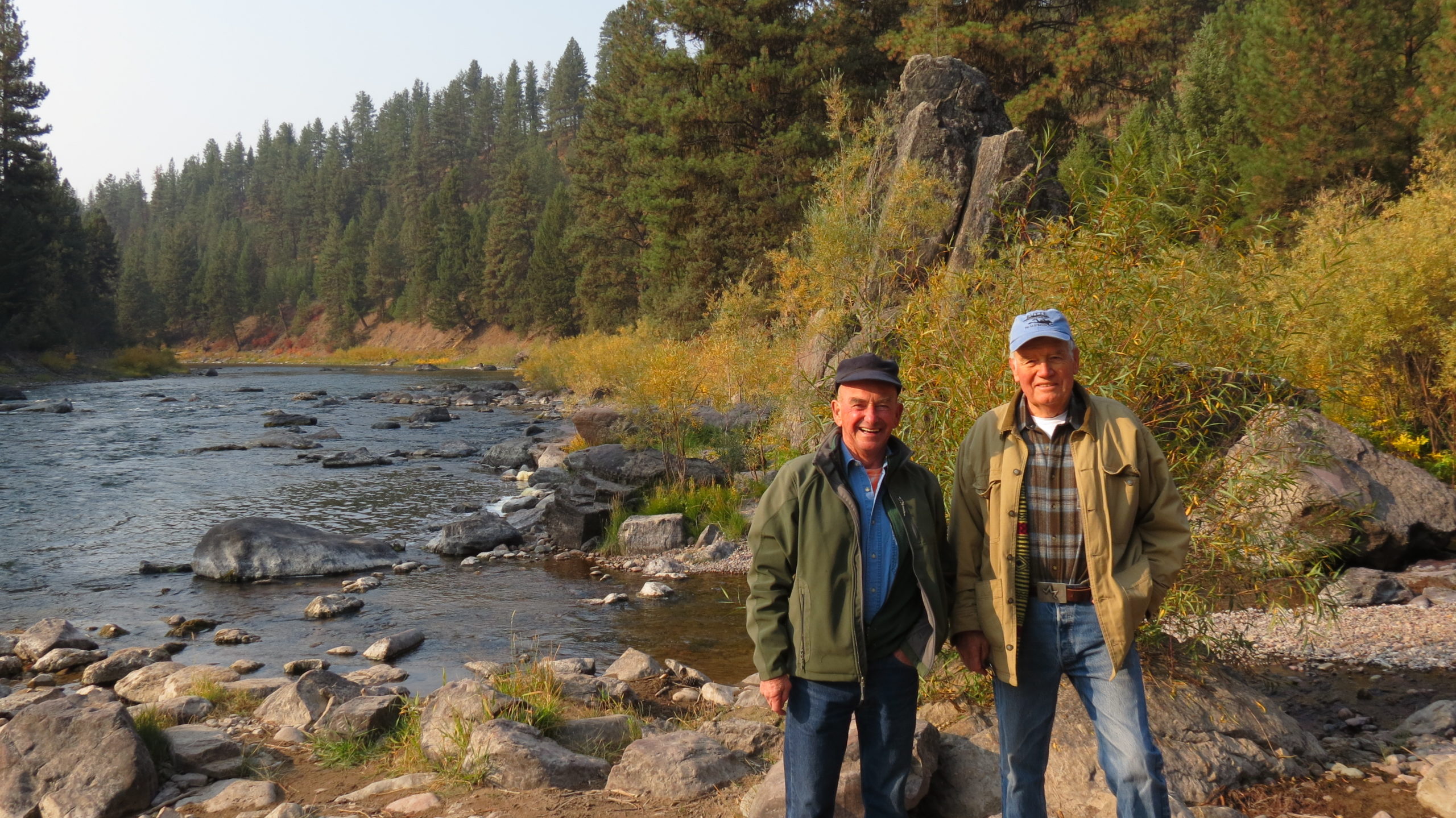
We knew that we could do a lot more together than we could do individually .
–Hank Goetz, former Lands Director
By the early 1990s, threats to natural resources and the rural way of life in the Blackfoot were coming to a head. A long history of poor mining, logging, and livestock grazing practices were taking their toll. Recreational use continued to increase and invasive weeds were spreading across fence lines. American Rivers listed the Blackfoot as one of the most endangered rivers in the nation, and native fish populations were “on a collision course with oblivion.” Furthermore, subdivision and commercial development threatened the rural, agricultural character of the Blackfoot as family ranches faced being sold and split up.
Before there was no forum by which to handle the impacts to the watershed. With the influx of new ideas and people, coupled with the different agendas of all the agencies, it was time to get in front of the potential issues and try to deal with them.
-Land Lindbergh, first Board Chair
As these pressures mounted, private landowners and public agencies began to recognize the need for a coordinated forum to exchange information and identify ways to respond. Local leaders held large public meetings and face-to-face discussions across the watershed to discuss the idea of forming such an organization. On the heels of the formation of the Big Blackfoot Chapter of Trout Unlimited, the Blackfoot Challenge officially formed in 1993 to take a ride-to-ridge approach to collaborative conservation in the watershed.
The mission of the Blackfoot Challenge is to coordinate efforts to conserve and enhance natural resources and the rural way of life in the Blackfoot watershed for present and future generations.
A key to the Challenge’s success since those early days has been the commitment to place and process of our volunteer Board of Directors. Every public agency that manages land in the Blackfoot watershed has a seat on the board. Additional leadership is comprised of private landowners, local business owners, conservation NGOs, and other watershed residents. All share a common belief in the Challenge’s community-based approach, and meet monthly to share information, listen and learn from one another, and prioritize program delivery.
The work we do is directed by a variety of committees and supporting work groups, each of which is chaired by a board member. Our committees are forums to bring people together, share information, and devise solutions to specific issues. Since the beginning, these committees have evolved along with the needs of the watershed.
Today, the Blackfoot Challenge includes 25 board members, 10 full- and part-time staff, eight committees, and seven work groups, all working hand-in-hand to achieve the mission of the Blackfoot Challenge.
Process

AT ITS CORE, the Blackfoot Challenge is a process. A way of working together. Here, we share some of the key tenets that we hold ourselves accountable to. By following this process, we find solutions that stand the test of time.
- Be inclusive; invite everyone to the table.
- Identify community leaders who are respected and respectful, collaborative and open-minded, and are able to represent diverse values.
- Practice the 80/20 rule. When you think of barbed wire, it’s the pointy part that comes to mind, right? When in reality, the majority of barbed wire is smooth. We believe it’s the same when talking about values. If we focus on what we have in common, the values we share, we can get stuff done without getting hung up on the barbs.
- Be open, transparent, and honest. This builds trust and credibility.
- Do not pick sides or take positions on issues. This puts trust and credibility at risk.
- Practice “proper pacing.” Stay in communication with your partners and don’t make decisions without them in the room.
- Facilitate a respectful conversation.
- Make decisions by consensus.
- Be willing to take it slow. Finding success through collaborative processes takes time. With greater participation and support, it will be worth it in the end.
- Get stuff done, share your successes, and celebrate!
We can agree on so many things if we just talk to people about what they want to achieve. If you can focus on the 80% of issues that we agree on, we can work together, build trust, and find success. Then if we do disagree, the trust is there to keep working on the other 20%.
–David Mannix, Board Member
The Watershed
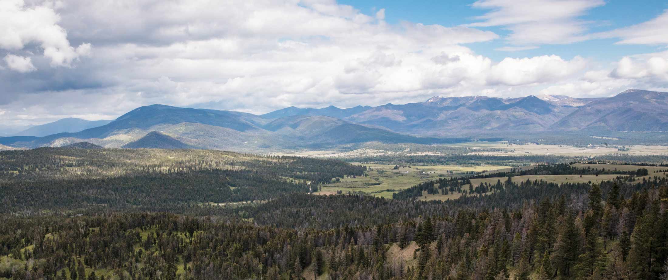
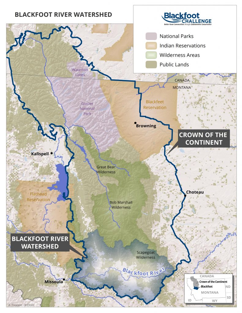
THE BLACKFOOT RIVER WATERSHED, located in western Montana, is well-known for its beauty, ecological diversity, recreational opportunities, and rural way of life. Beginning at the Continental Divide east of Lincoln, the Blackfoot River runs 132 miles westward to its confluence with the Clark Fork River just east of Missoula. The 1.5 million-acre watershed forms the southern end of the Crown of the Continent, one of the most ecologically intact ecosystems left in North America. Every species that was known to exist when Meriwether Lewis made his return trip east along the Blackfoot River in 1806 still resides here today.
A history of glaciation left the Blackfoot watershed with a mosaic of habitat types that support a wide variety of fish and wildlife species. Higher elevations – including the Rattlesnake and Scapegoat Wilderness Areas – support trees such as subalpine fir and Engelmann spruce. Low and mid-elevation forests are dominated by ponderosa pine, lodgepole pine, Douglas fir, western larch, cottonwood and aspen. The watershed floor – characterized largely by private ownership – is covered with meadows, sagebrush steppe and native bunchgrass. The greatest source of biological diversity in the watershed arises from wetland features such as glacial “potholes,” basin fed creeks and spring creeks, marshes, shrubby riparian areas, and cottonwood forests. Rare wildlife species that call the Blackfoot home include grizzly bear, gray wolf, Canada lynx, wolverine, sandhill crane, and trumpeter swan, among many others. The river and its tributaries house a world-renowned blue ribbon trout fishery, providing habitat for the native bull trout and westslope cutthroat trout.
Unlike other watersheds across western Montana, the Blackfoot is relatively undeveloped. Cradled between the larger cities of Missoula and Helena, the Blackfoot remains rural with approximately 9,000 residents. Seven communities dot the landscape, from Lincoln at the headwaters of the Blackfoot River down to Bonner at the mouth with Helmville, Ovando, Seeley Lake, Greenough, and Potomac in between. Logging and ranching remain principal livelihoods and still shape the core identities of most communities, while newer economies based in recreation and tourism are on the rise.
This rich diversity of communities, wildlife species and habitats in the Blackfoot watershed is complicated by a checkerboard land ownership pattern that dates back to railroad development and settlement of the west. Nearly 10 unique agencies or organizations own and manage land in the Blackfoot, in addition to private landowners. This complexity gives rise to the need for a coordinated vision and management approach across the entire landscape. While founders of the Blackfoot Challenge recognized the inherent “challenge” in bringing all these partners together, they similarly recognized the opportunity that collaboration presented for the long-term success of the Blackfoot watershed.
Header photo: Mannix Brothers Ranch